Day 5 – “It’s a boat time…”

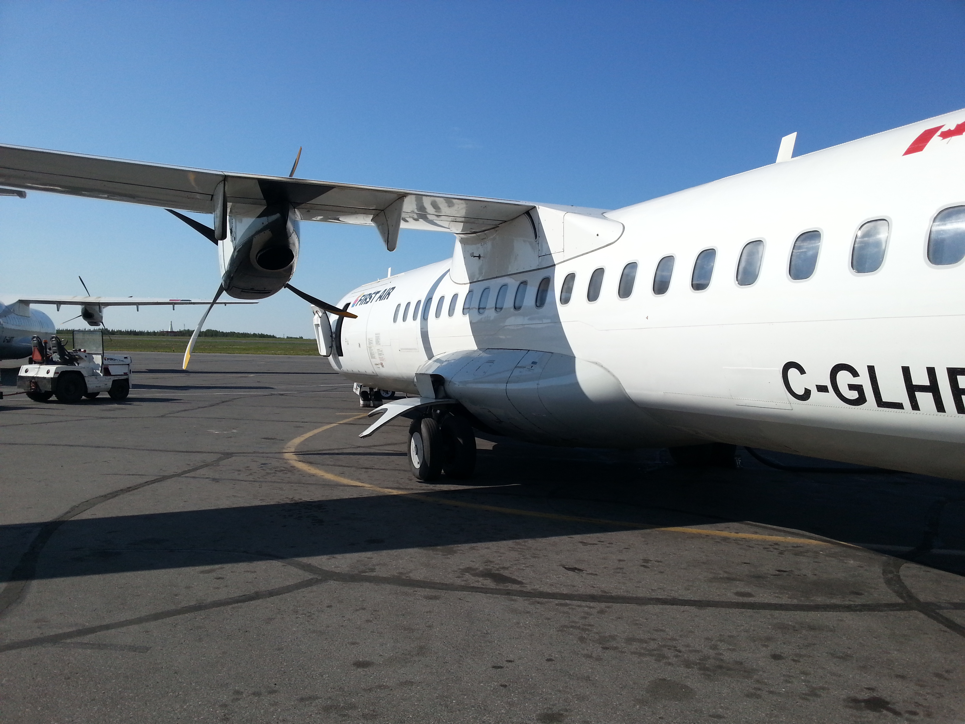
First off, in order for the title to work, you have to say it in your best (or worst) Canadian accent. Now that I’ve covered the ground rules, here is my blog post for the day!

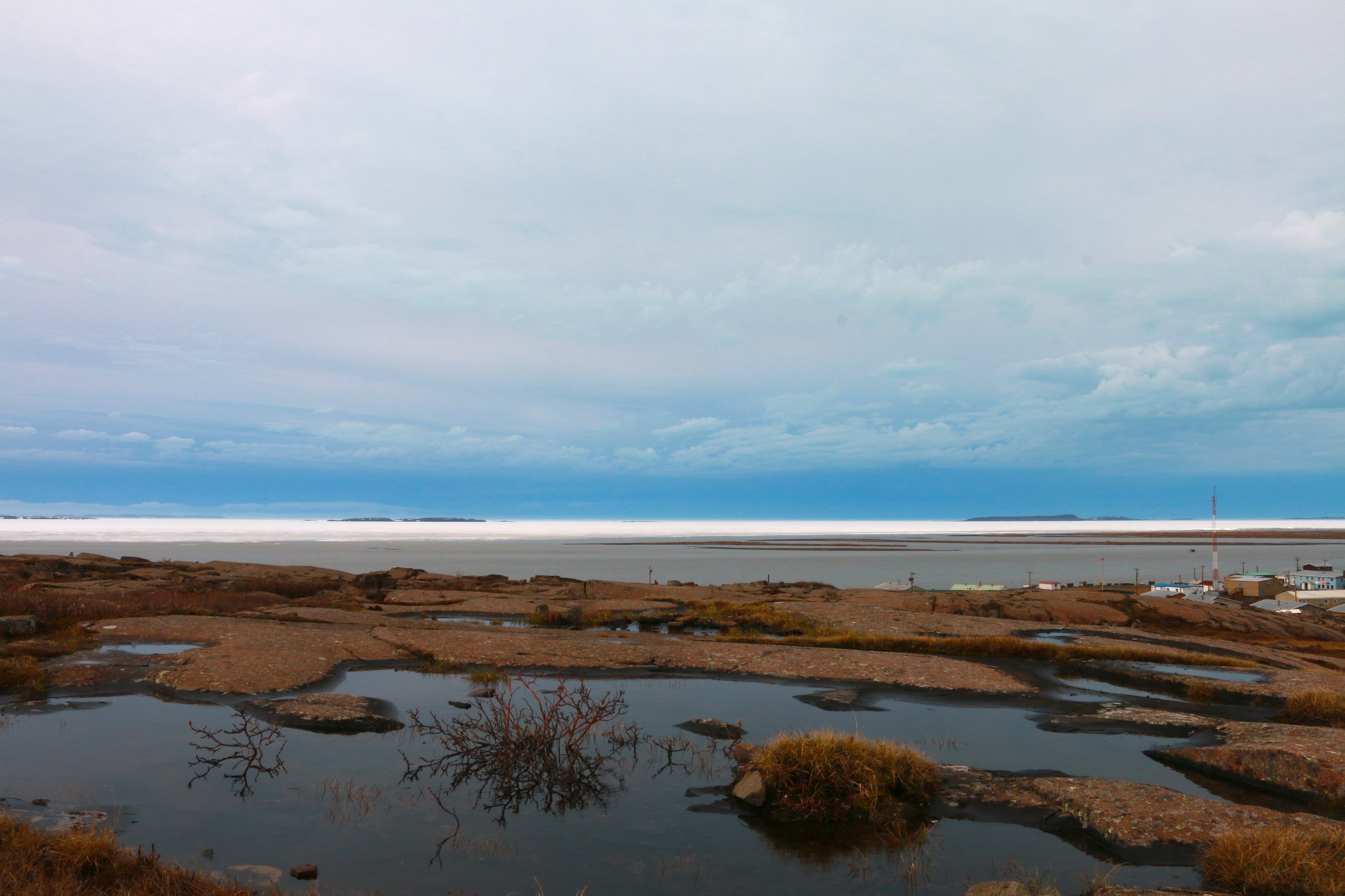
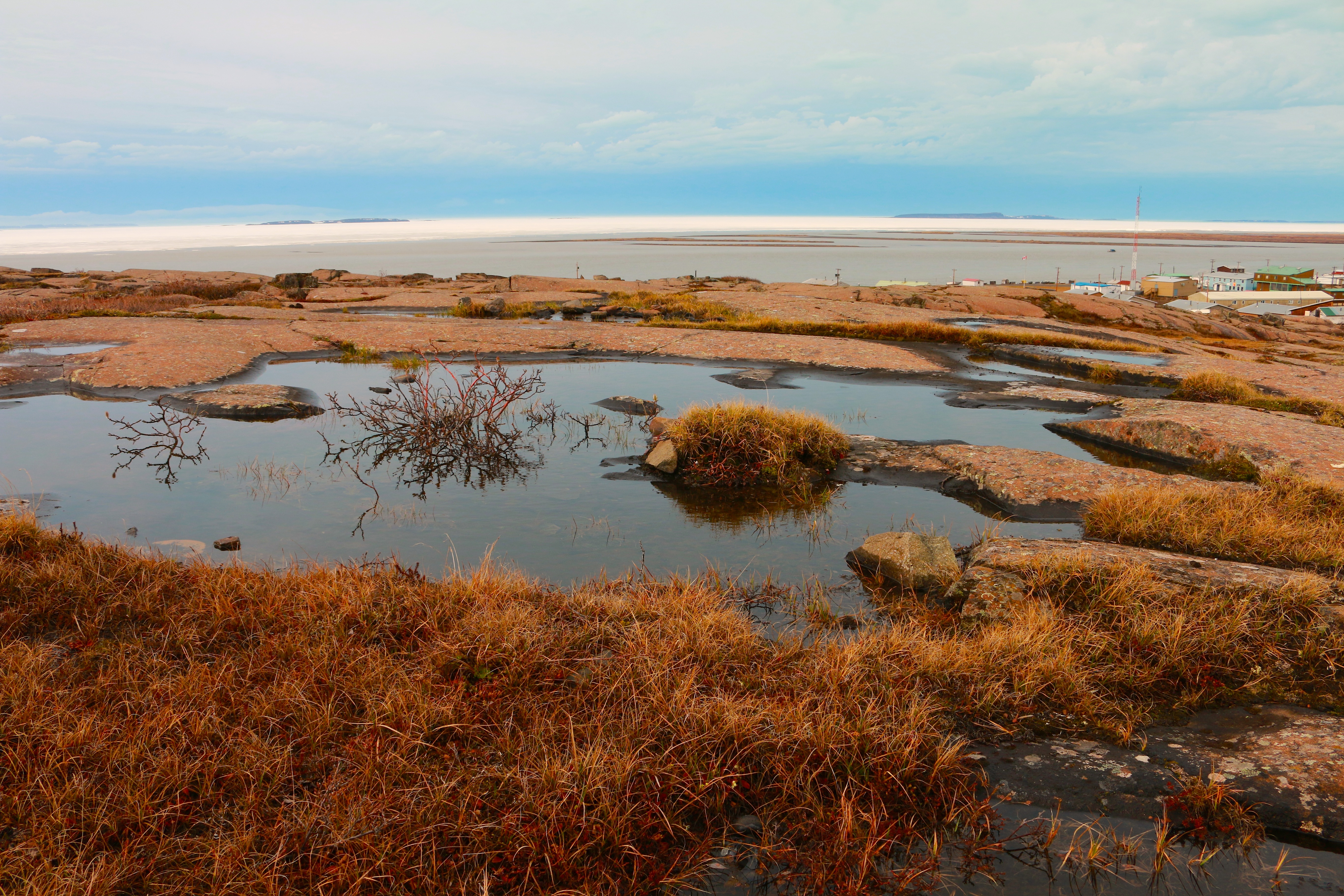
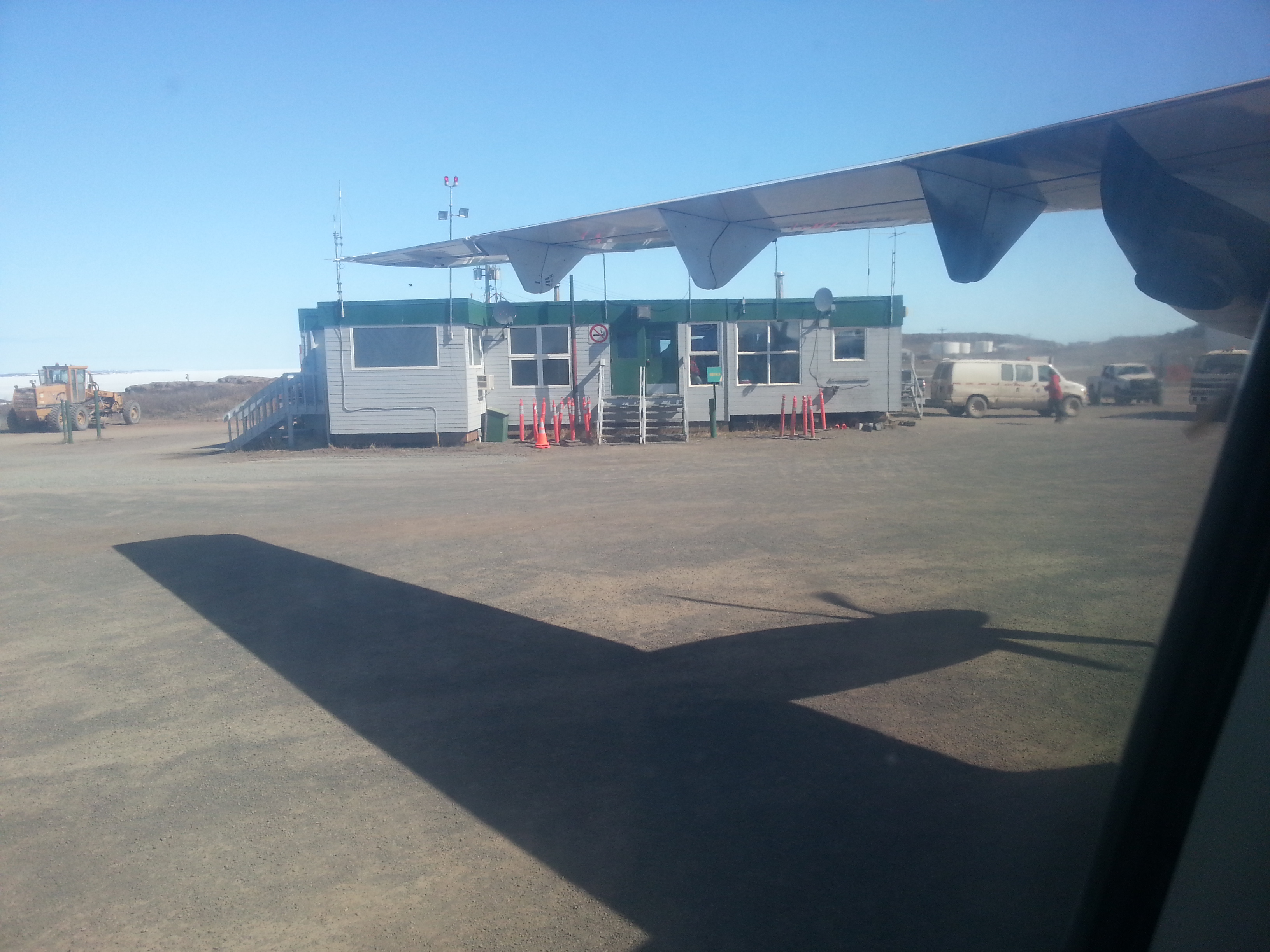
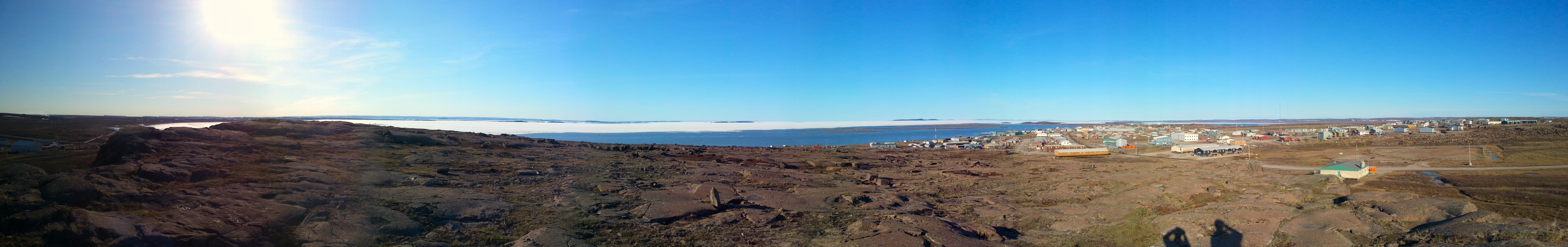
The morning started off with a peek through the window in my room. Fog clouded my view of the bay below – we would have to wait for this to clear before we could take the boat up river. I packed my bag for the day and went out to breakfast to discuss the plan. As I munched on Cheerios and toast, the sun started to burn through the fog. By 9:00 AM the fog had almost completely lifted. We organized the research coolers for the day and packed up the van. One last check of necessary materials: bear spray – check, pocketknife – check, water – check, satellite phone – check. By 9:45 we were on the road down to the Hunters and Trappers Organization (HTO) to meet Barb and our boat driver for the day, David.

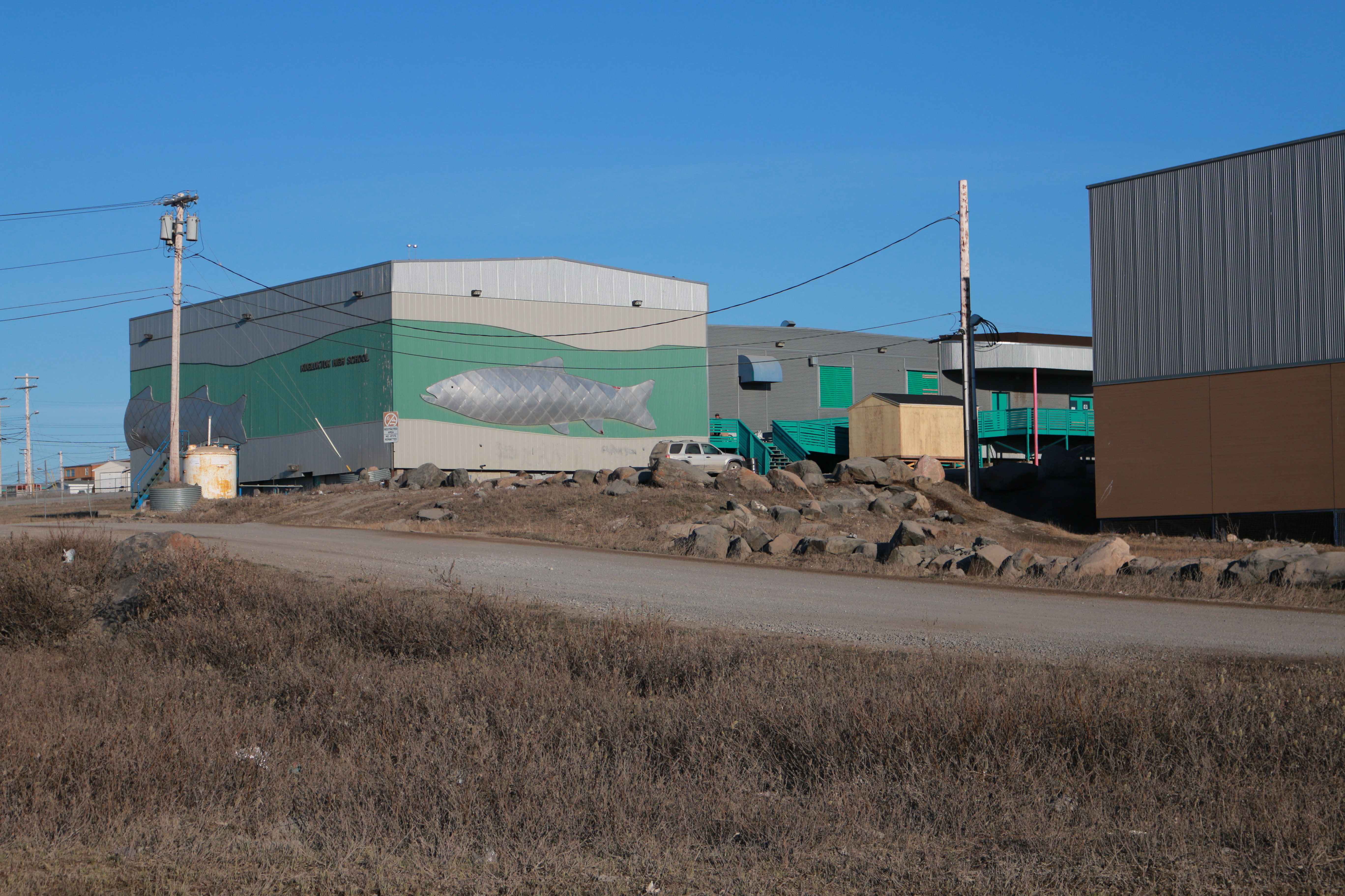
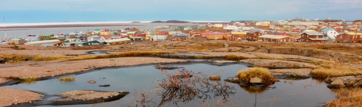
As we pulled up several men were bringing their morning’s catch to Barb and David. In each bag was an arctic char measuring between 24-44 inches. The HTO prepares and freezes the meat and will distribute the food to the community to help those people who do not have enough to eat. There is a strong network of support in the town of Kugluktuk, and we have noticed this in the short time we have been on the ground here. For instance, when we mentioned to Barb that we would like to have a boat to take samples up river, she called David who was willing to give up several hours of his day to help us with our project. Each step along the way, members of Kugluktuk have made us feel welcome despite having wandered far from home.

The water line from just a few days earlier is visible on the side of the hill. The water level was almost ten feet above its current height. (Photo credit: John Kelly)

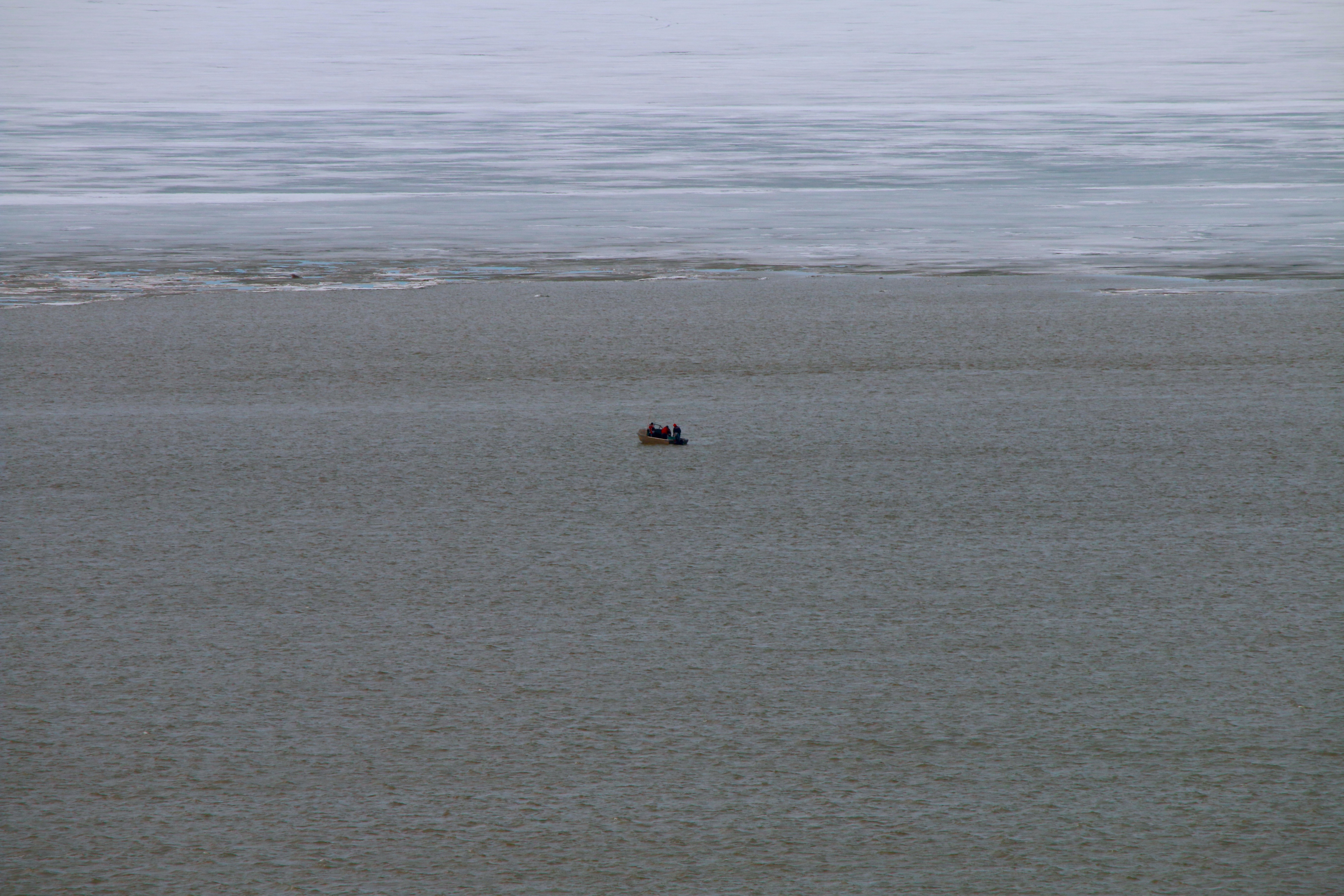
We grabbed our life jackets, donned our waterproof raincoats and pants, and took off for the shore to meet David at his boat. One thought kept coming to mind as we neared the frigid water of Coronation Bay – “one minute to control your breathing, ten minutes to use your muscles, one hour before you lose consciousness.” This past spring break, while individuals flocked south to find warm, sandy beaches, Greg and I went to the Pacific Northwest, to the University of Washington, for several classes to prepare for this summer. We were taught about small boat safety, bear safety, emergency preparedness, and small river crossings. Along with Matt Alkire, we learned to always wear life jackets on the water (of course…), to tell others where you are going, stay calm in emergencies, and many other life-saving bits of information. Perhaps most useful and impressive was the section on hypothermia. In the event that one of us were to fall into water in the Arctic, it is important to remember how much time you have to do several important things – “one minute to control your breathing, ten minutes to use your muscles, one hour before you lose consciousness.” This sequence of events was brought home by Dr. Gordon Giesbrecht in this video. He staged a scenario where he fell through the ice on a frozen lake. He talked through each of the steps in the moment, while he is experiencing the symptoms from his predicament. He emphasized that the goal of the video is to save lives. The lines run through my head once more as we pull up to the boat – “one minute to control your breathing, ten minutes to use your muscles, one hour before you lose consciousness.” Okay, maybe I’ll just focus on not falling in…

Dr. Rob Macdonald, Ph.D. sits at the bow of the boat as we make our way up the Coppermine River. (Photo credit: John Kelly)

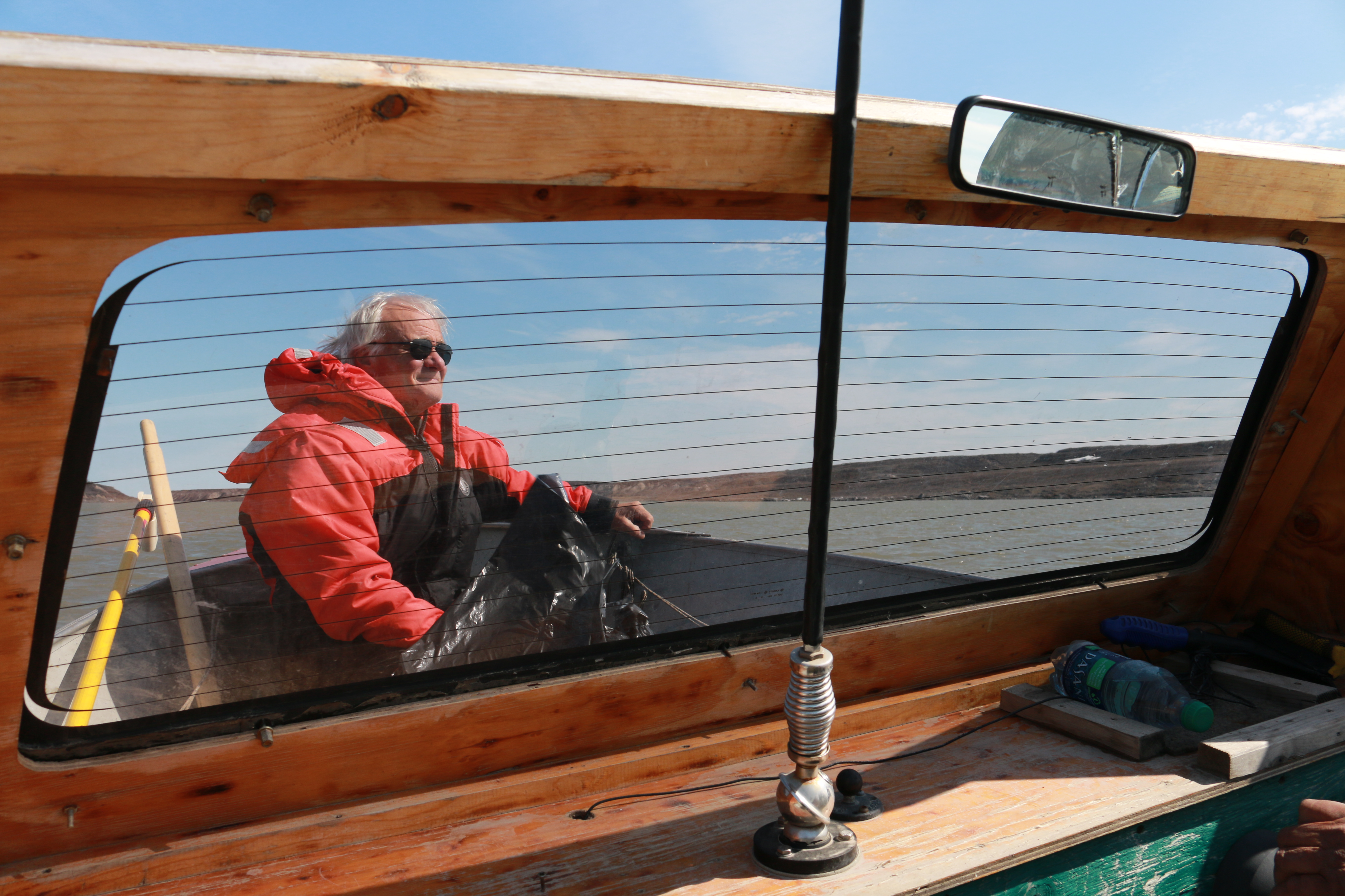
We tossed our gear into David’s boat and strapped on our life jackets. With a nudge from a man onshore we floated free and started heading up the shoreline toward the mouth of the river. A light fog wisped around us and the icy air just above the water revealed any exposed skin. David guided the boat skillfully, avoiding low points and other objects in the river, including chunks of ice.

Layers of sedimentary rock formed as silt and other river sediments were deposited at the mouth of the river long ago. (Photo credit: John Kelly)

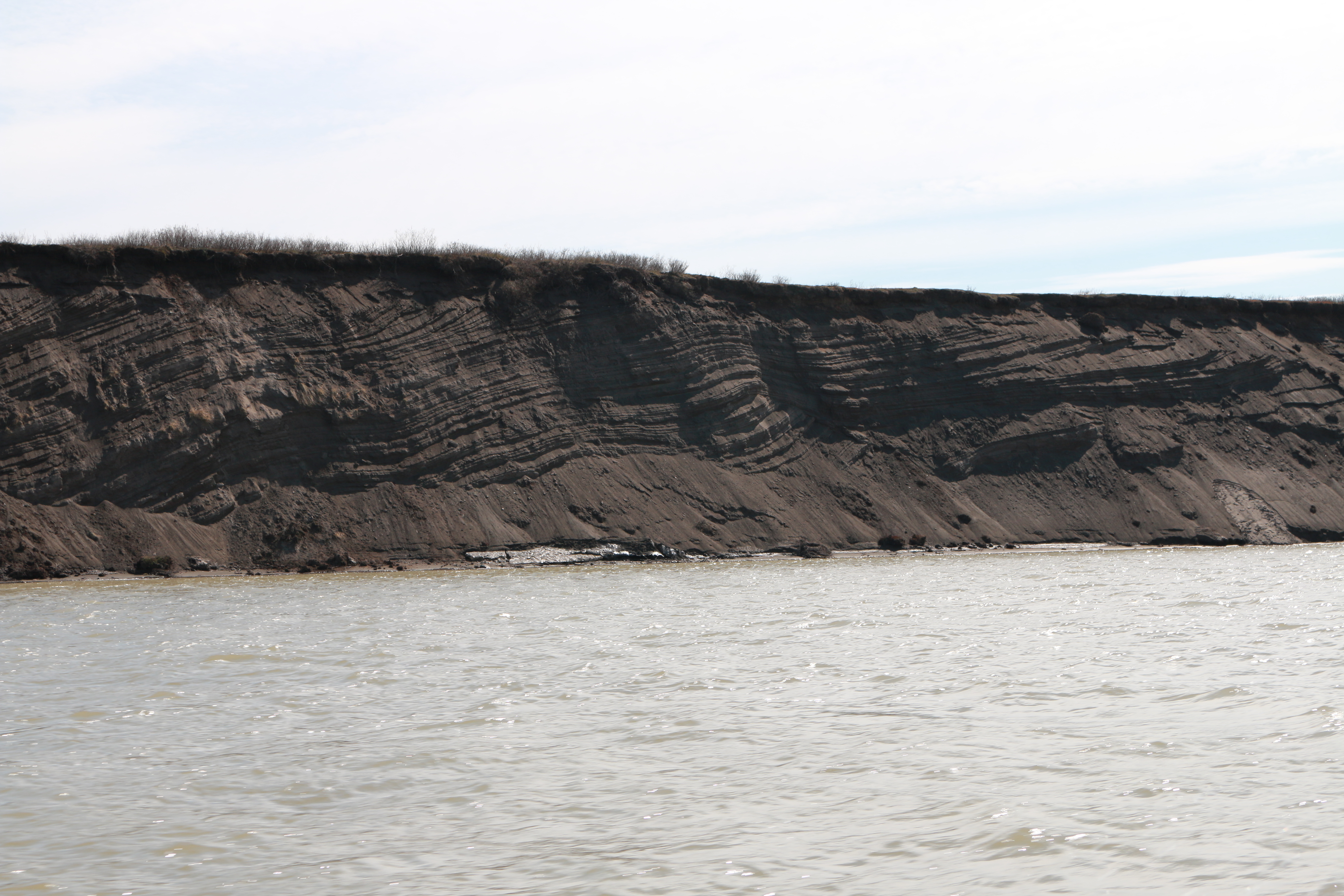
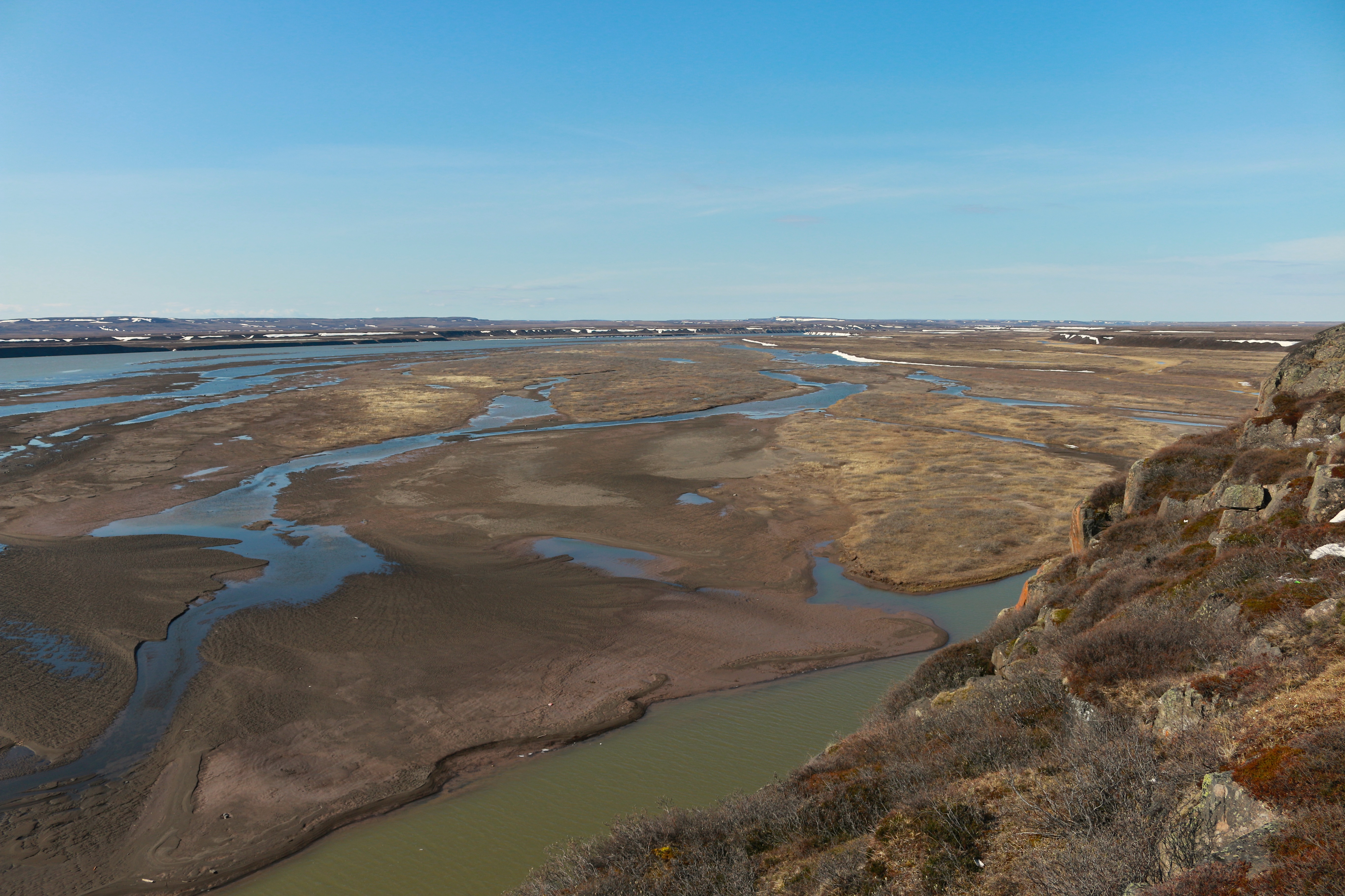
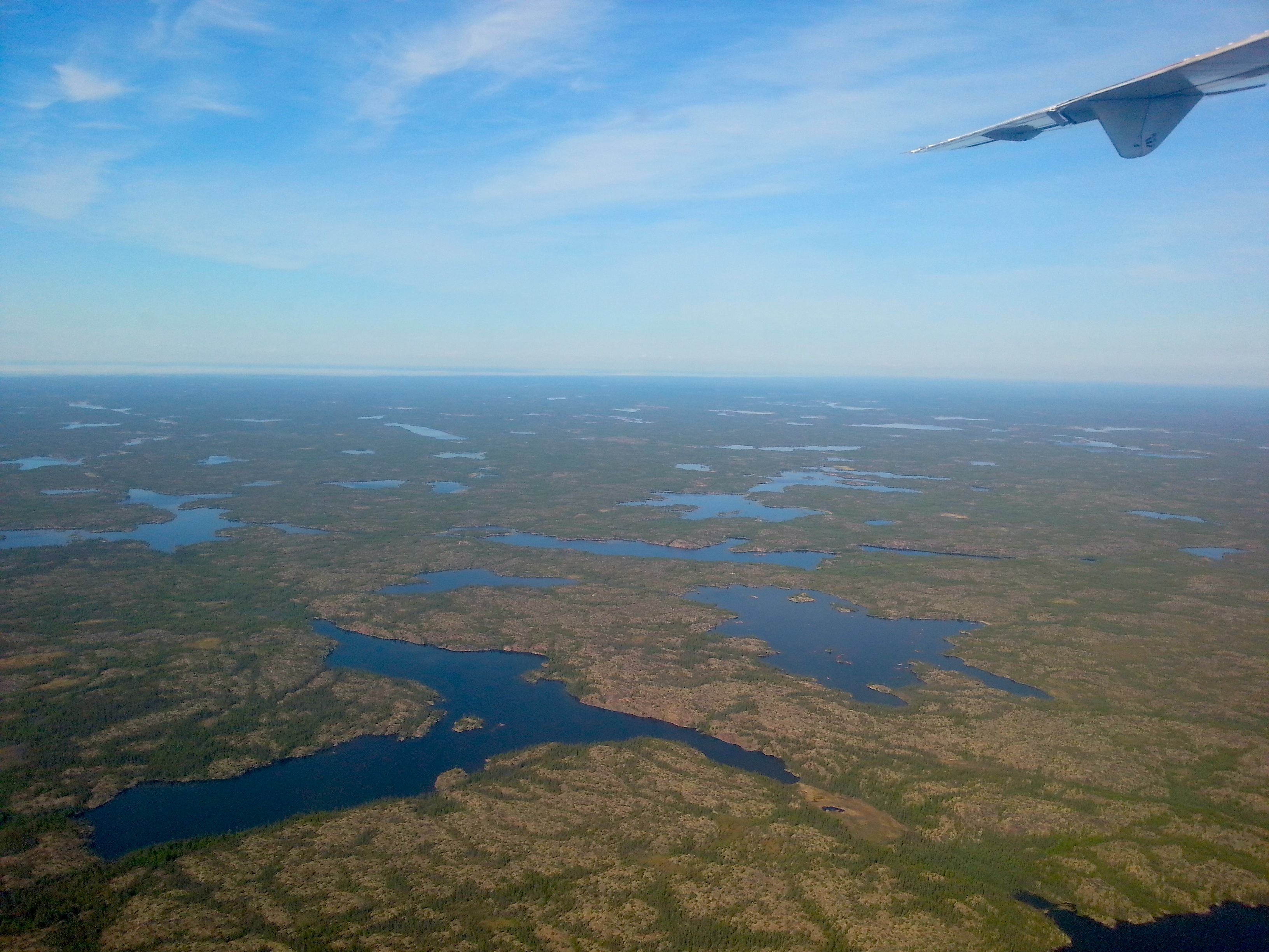
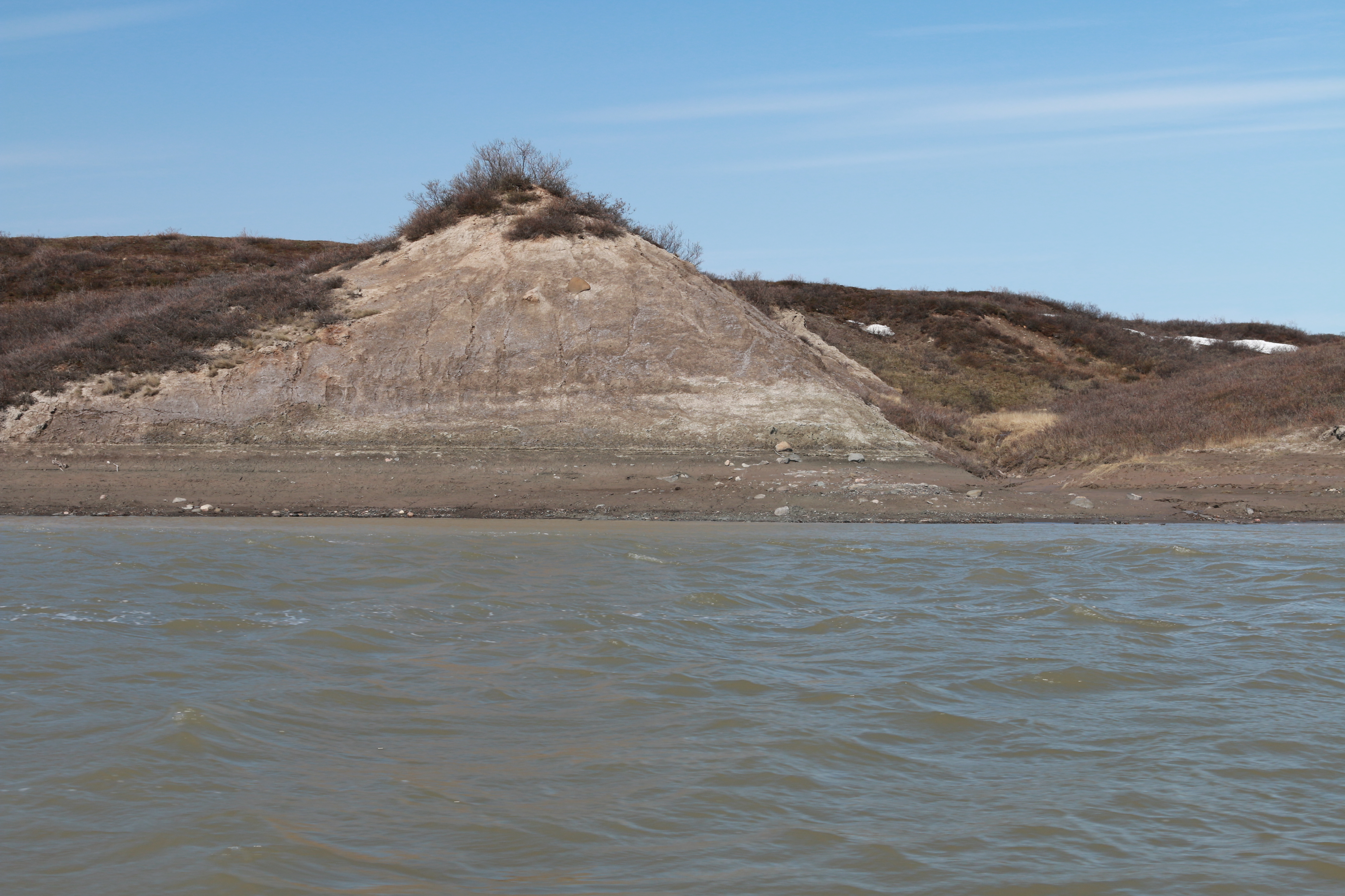
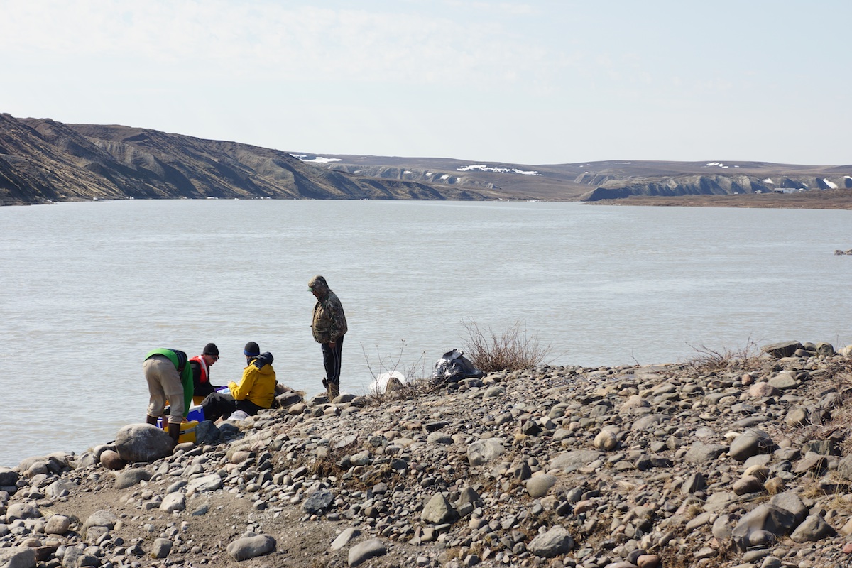
The hills on either side of the river rose sharply, exposing layers of sedimentary rock, deposited long ago as sediment fell out of the river and settled on the river bottom near the mouth. We stopped about a mile upstream where the channel narrowed. In order to get a better profile of the river, we decided to collect three measurements, one on either side and one in the middle. We pulled over to the shore and hopped out into the mud.

The first site along the Coppermine River. Slowly, we work out the kinks in how we are collecting water samples. (Photo credit: Rob Macdonald)

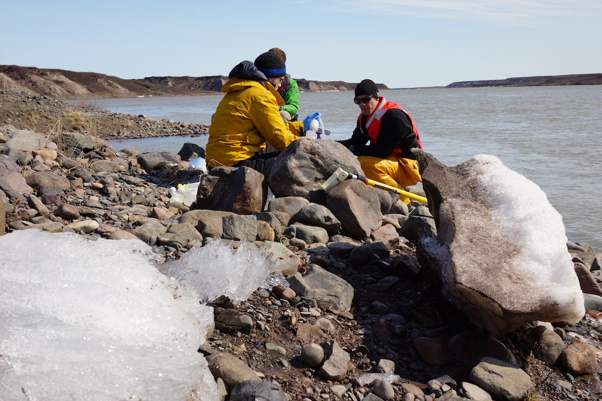
The shore was muddy, despite being covered in vegetation. Only a few days ago, the water level was several meters higher from the pulse of ice and freshwater flowing downstream due to the river breaking up. We grabbed our gear and slogged to a place on the shore not covered by mud to start sampling.

The group works diligently as David, our boat driver, observes the collection process. (Photo credit: John Kelly)

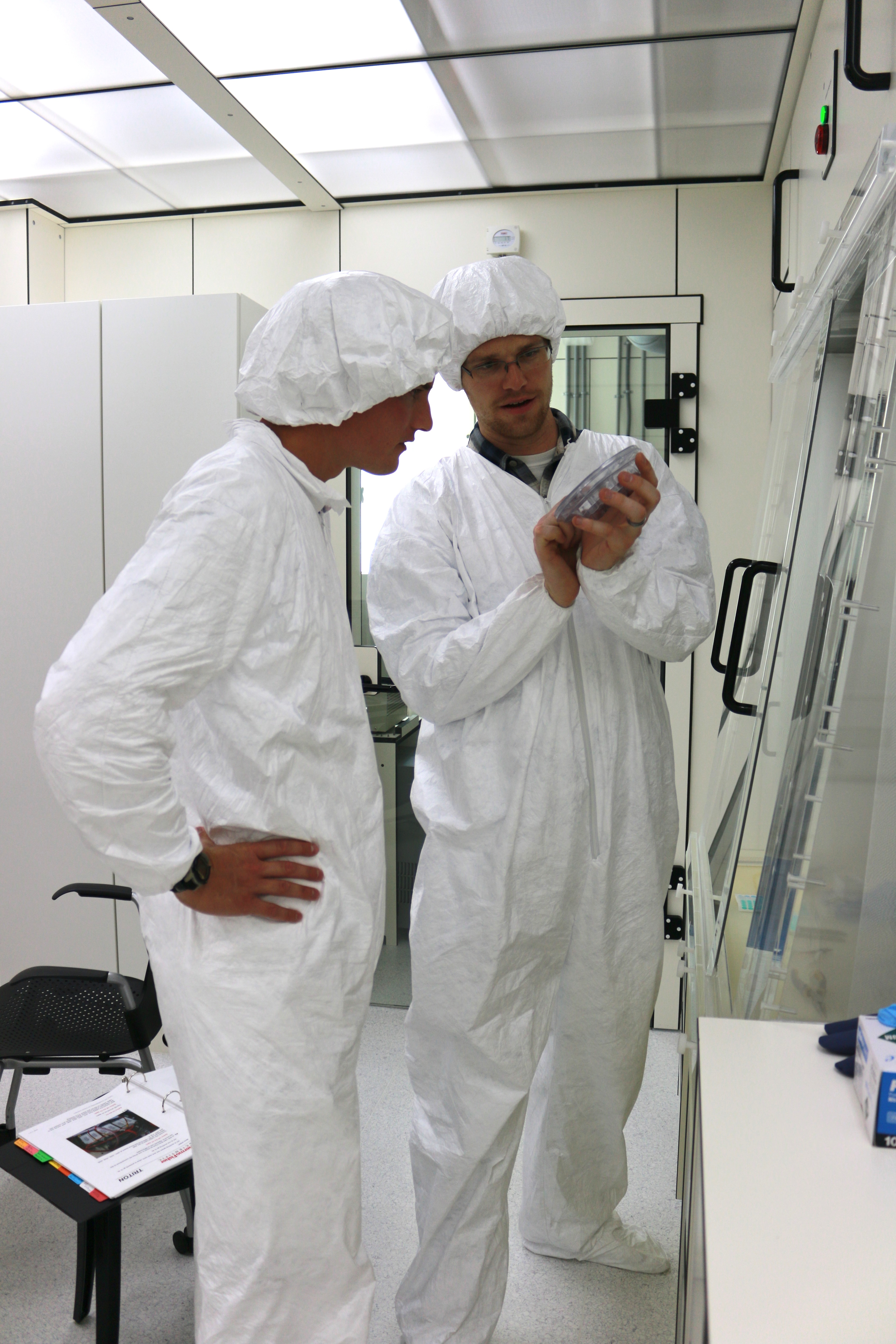
Greg and Matt reviewed how they wanted the samples collected and re-emphasized the importance of preventing contamination.

Researcher Matt Alkire uses a telescoping pole to collect water from the river. (Photo credit: Rob Macdonald)

It was pivotal to keep any dirt, sand, mud, hair, and other objects out of the water once it has been pulled from the river.

Water sampling requires teamwork and coordination. Gloves are also necessary to make sure we do not contaminate the samples. (Photo credit: Rob Macdonald)

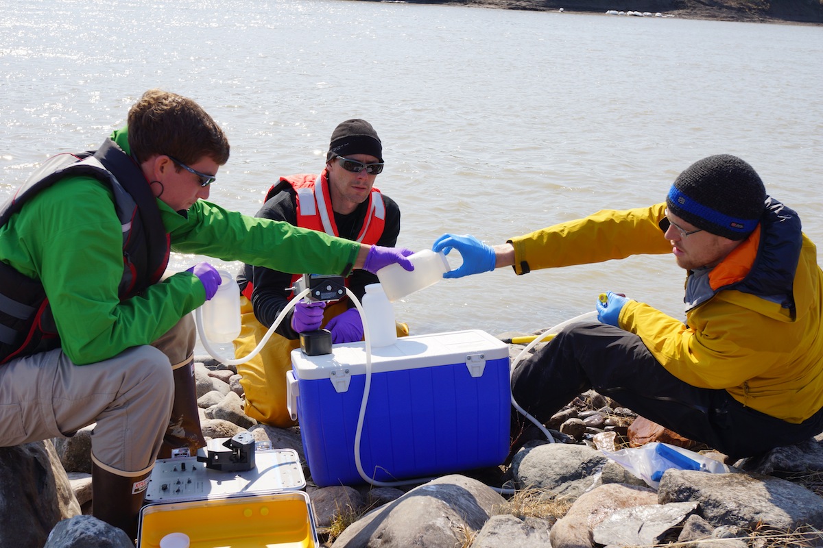
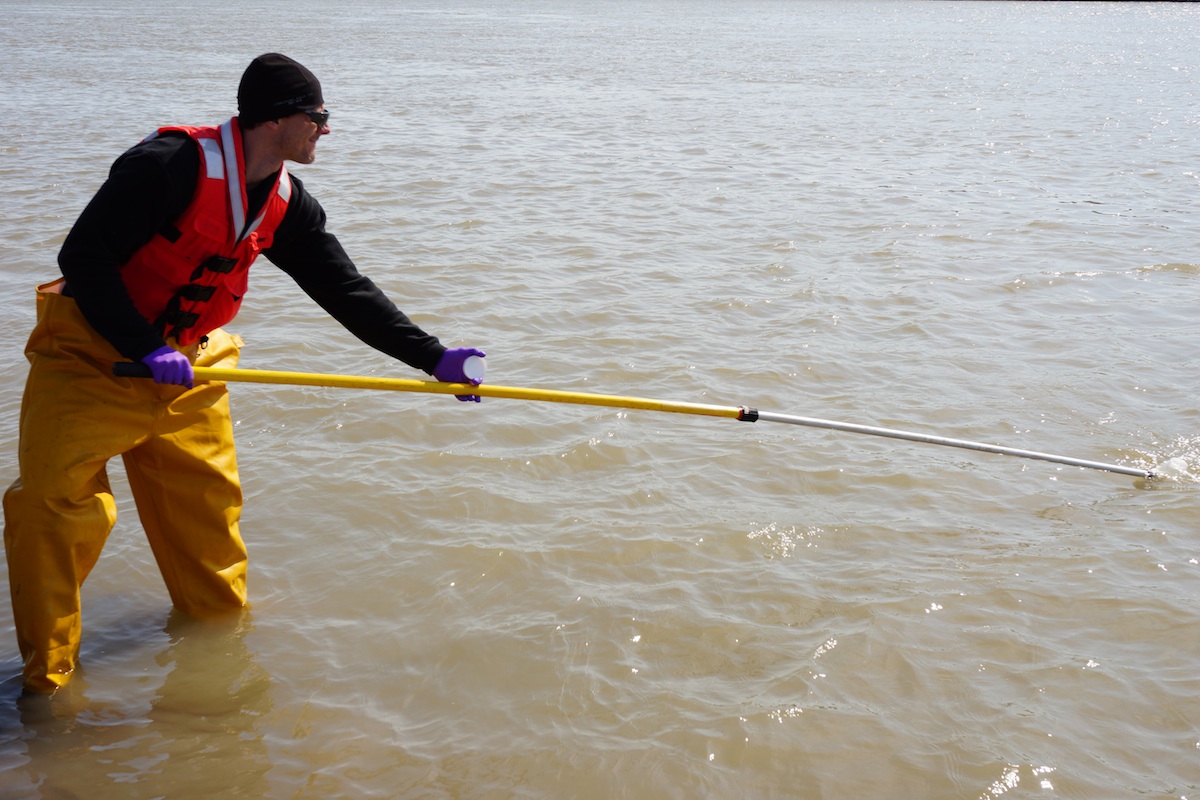
In order to collect several liters of water ‘quickly’ we used something called a peristaltic pump. Despite the complicated name, it operates in a similar way to how we swallow food. Tubing runs through the middle of a drill-operated pump that squeezes water through the tubing and into our bottles. It took us almost an hour to fill all of the bottles for the first site, partially due to some complications with the pump. After we completed these measurements we lugged our equipment back to the boat and set off for the middle of the river.

Researcher Greg Lehn fills a bottle for sampling. Slowly, we perfect our technique. (Photo credit: Rob Macdonald)

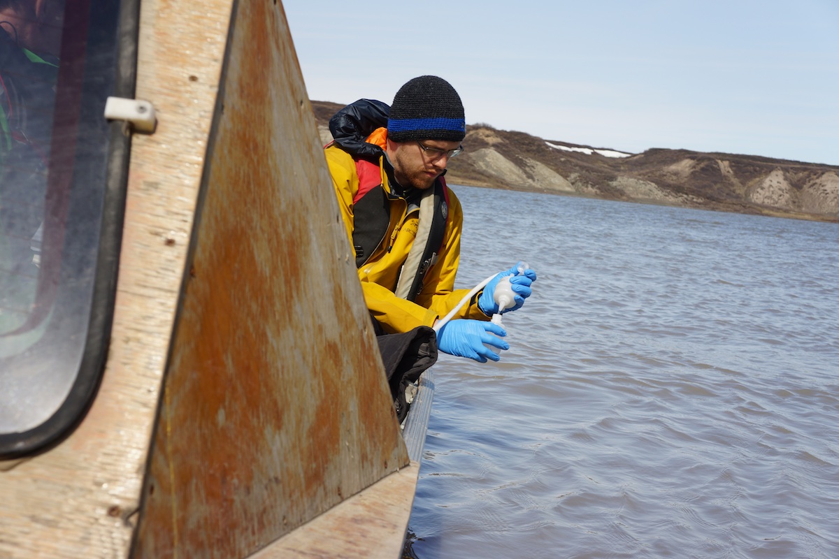
The river measured approximately 200 meters across at this narrow point. We set anchor in the swift current and began taking samples.

The purpose of this study is to obtain a chemical fingerprint that can be used to determine where the water from this river (and the six others we are measuring) goes once it enters the Arctic Ocean. The interaction between freshwater and saltwater is interesting and complex. In most cases freshwater is less dense than seawater. Due to its density, freshwater behaves in a similar way to oil that sits “on top” of water. The subtle differences in density are enough to prevent water from deep down to circulate to the surface in the Arctic Ocean. This property (which is a simplification of the overall process, but I don’t want to bore you with all the details here) is what allows ice to form in the Arctic Circle. Similar to salt being thrown on the road and sidewalks during winter, saltwater in the Arctic Ocean freezes at much lower temperatures than freshwater. This project will provide the first set of measurements from small Canadian Arctic rivers in the hopes of seeing how much freshwater they contribute to this cycle and where this water goes. Still with me? If I set you adrift somewhere, I’ll toss you a rope and pull you back into the boat with us!

We finished collecting samples in the middle and far side of the river. After sitting in the boat for almost three hours, my hands were nearly frozen despite being bathed in sunlight all morning. The temperature was still a chilly 5 degrees Celsius (41 degrees Fahrenheit) and windy. We finally pushed the boat off from the shore and sped off downstream. The wind had picked up since we left, which made the ride back much choppier. A few large chunks of “candle ice” melted on the shoreline, unable to resist the pressing waves of summer.

A large chunk of ice falls into the river. This ice used to be at the level of the river, but is starting to slough off as the water level has dropped and the temperature has risen. (Photo credit: John Kelly)

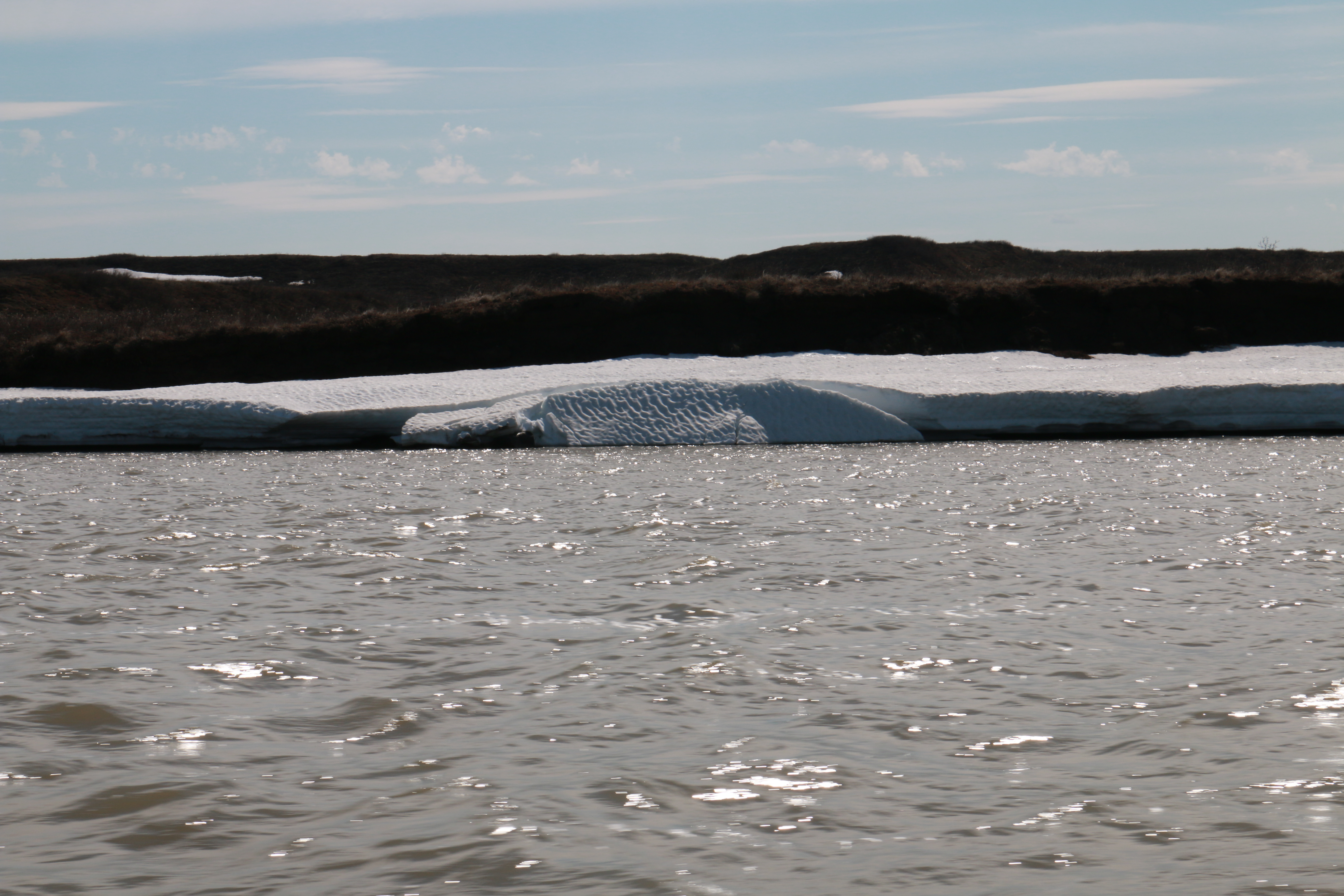
By tomorrow these chunks of ice will be gone. We returned to the beach and unloaded the boat. We thanked David, our captain, and he pushed off into the Bay to begin checking nets again for more Arctic Char.

We drove back to the Inn and brought our gear inside. My stomach was growling having missed lunch, so I decided to wander to the Co-Op store for a snack. You know how they say never shop when you are hungry? Well that point becomes even more apparent when the items you would normally purchase as snacks are two or three times more expensive. I bought a bag of chips, gummy worms, and a few bananas and spent $20.00. My wallet winced a bit as I put the receipt inside, but alas my stomach’s grumbles won out. I walked back to the Inn munching on my snacks, occasionally stopping to talk to people who were selling some amazing, hand-carved trinkets. I mentioned that I would be interested in a carving of a whale or bear, but did not want to buy anything today. Roy, the man who was showing me his carving, nodded and said he would see what he could do. This would not be the last time I would hear from Roy.

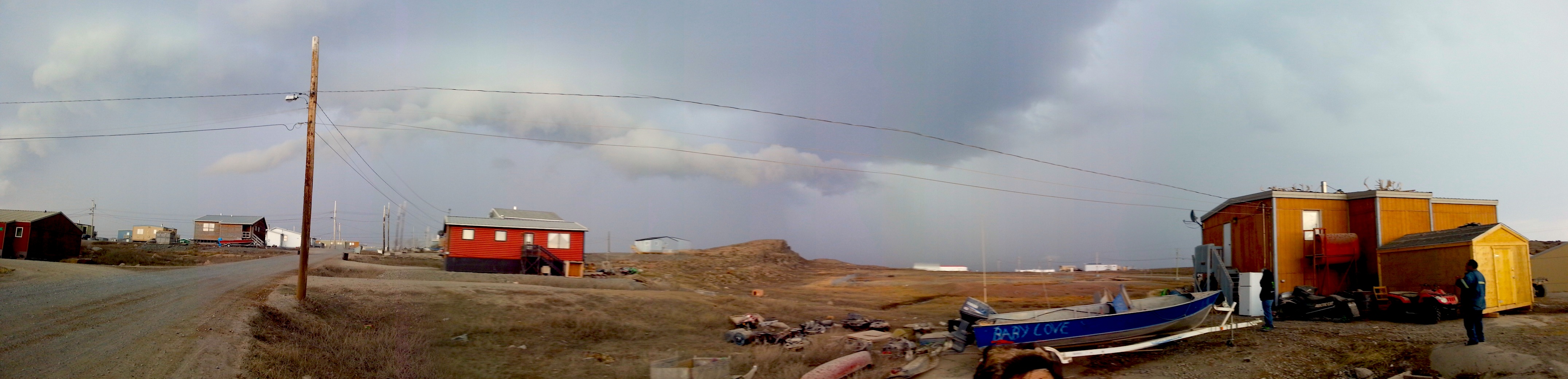
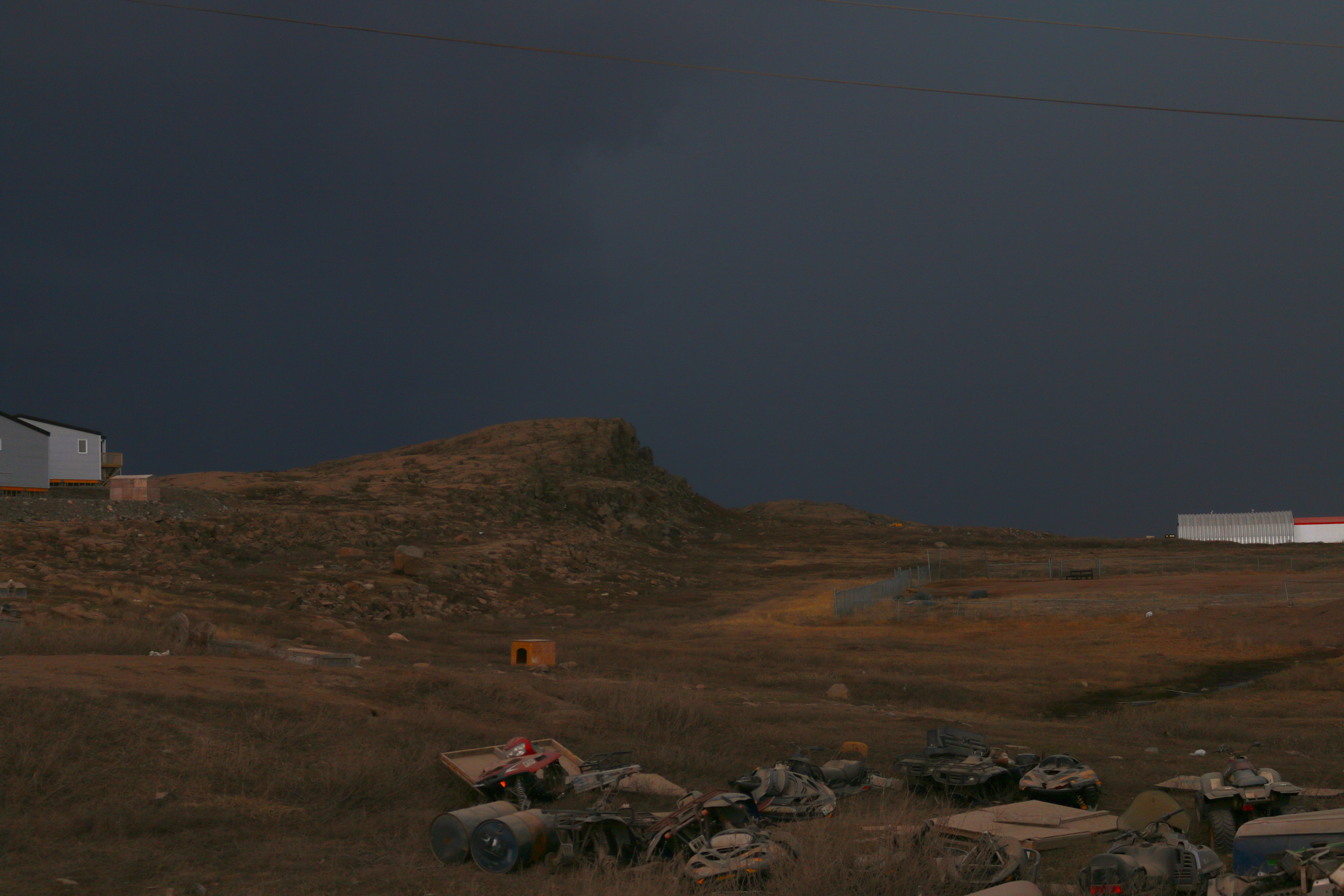
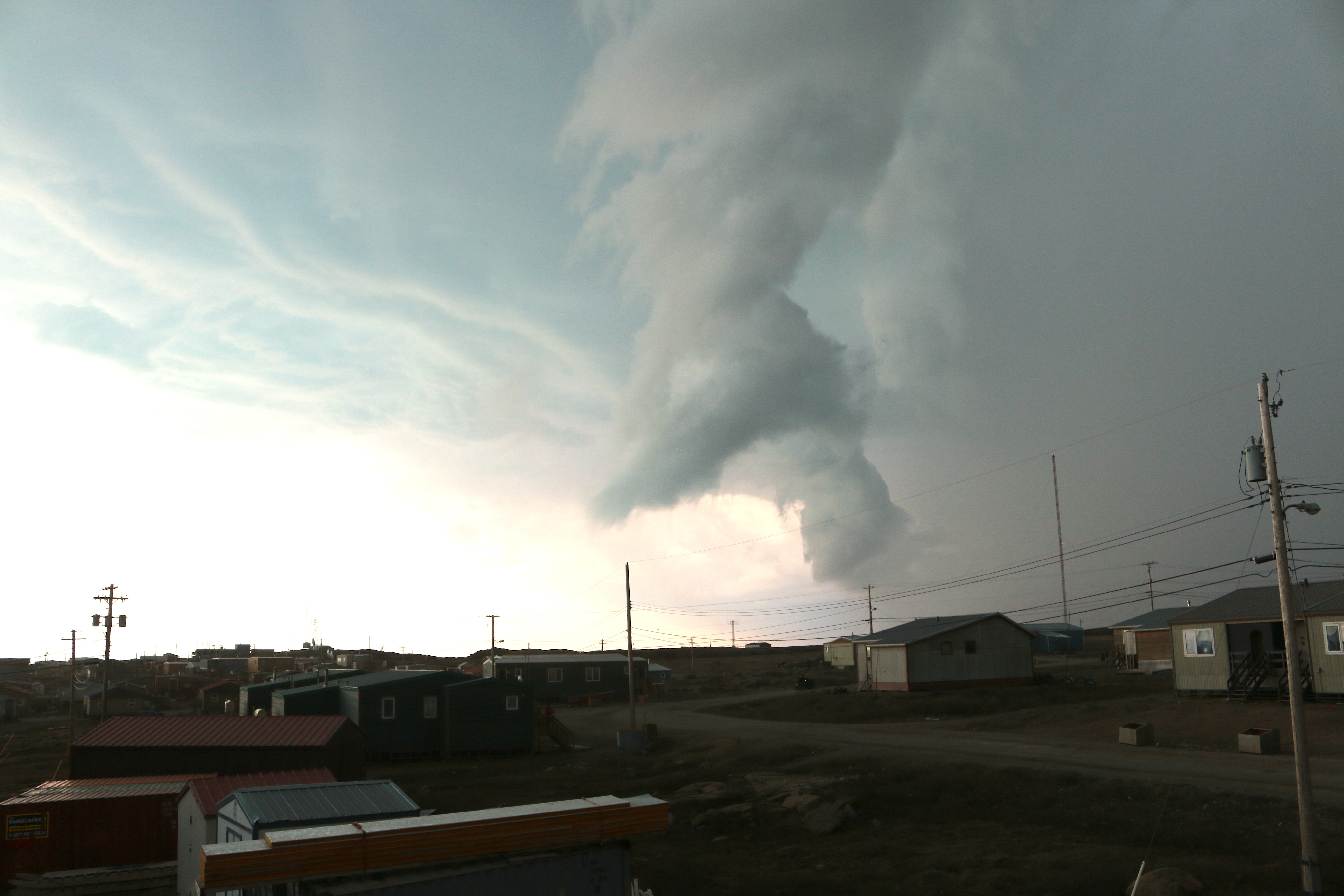
Dinner was another delicious meal provided by Johnny and Nadene. We all left the table thoroughly stuffed. For the second time in two days a thunderstorm moved over the town of Kugluktuk. Lots of lightning was accompanied by heavy rainfall.

Rain moves in on Kugluktuk for the second day in a row. Storms like this are extremely atypical and unseasonal. (Photo credit: John Kelly)

This storm hovered over the town all night long. With nowhere we needed to be after dinner, I sat on the porch of the Inn and watched the storm roll by. Two unseasonal storms in two days. Today’s sample collection was a success – the first trial for a three-year study. Tomorrow we plan to show Jorgan and Christian, both 19 years old, how to collect the samples. They will have a part to play in helping their town, Kugluktuk, understand how their Coppermine River contributes to the Arctic freshwater input. The fact that they are enthusiastic about the opportunity shows human nature’s ability to take on challenges with unknown results. That individuals are trying to redefine their community given new circumstances gives me hope.

Day 4 – “A storm is coming”

Today we woke up early, grabbed some breakfast, and set off into the field in search of a good sampling location. On the east side of town is a road that extends toward the Coppermine River and the town’s pump house. The goal for the day was to find a location where we could easily collect water samples that were representative of the geochemistry of the entire river. Geochemistry combines chemistry and geology to better understand the major mechanisms that direct geological systems.

The delta of the Coppermine Rver as it empties into Coronation Bay. A large sandbar has formed to the side of the main channel from millions of years of erosion and deposition. (Photo credit: John Kelly)

Despite the pump house being easy to access, we decided to walk on in search of a better location. To our left the hill descended quickly to the valley floor. The river widened as it flowed into the bay. Tiny purple flowers and willow bushes began to open their petals and leaves to the sunlight. We ascended the red-rock hill in front of us and the view of the valley floor opened up below. A large sandbar extended from the bottom of the cliff toward the river. No easy path presented itself through the marsh so we decided to head back to town and await our meeting with the HTO Board of Directors.

We arrived at the Hunter and Trapper Organization (HTO) headquarters and sat down in their boardroom for our meeting. Barb made a pot of coffee for us in the background as individuals from Kugluktuk started to arrive. Several people showed up to our meeting – two men, Christian and Jorgan, who will collect the water samples, Fredd and Kevin volunteered as our wildlife monitors, and David was the head of the board. After introductions, Matt Alkire began to describe the project to the group.

The group had many questions for us. Why did we want water samples from the Coppermine River? What effect might this study have on the local community? How did we envision the HTO helping with this project?

Matt, Greg, Rob and I responded to each of the group’s questions and this appeared to put them at ease and they seemed excited for the project too. We also had many questions for the board. The people of Kugluktuk have observed many changes in their town with the weather, climate, and timing of events. These anecdotal changes provide a picture of an ecosystem that is rapidly changing and unpredictable. They emphasized that it is very important to them to see the Coppermine River protected and they want to better understand the changes occurring in Kugluktuk.

We settled on a plan to meet tomorrow and take a boat up-river to find a nice sampling site that Christian and Jorgan will be able to access for the remainder of the summer. The group went outside and we started to prepare a boat for the trip. While we checked over the engine there was a part that was disconnected and laying underneath the engine block. With any luck this is not an important part – regardless we will find out soon…. After the boat was ready for the morning we headed back to the Inn.

Before dinner we decided to go check out the Co-Op, a grocery store/hardware store with many other general items. I had been forewarned that certain foods can be much more expensive in the Nunavut, but I was humorously surprised by what I discovered. Are you hungry for some milk and cookies? That will be $16.00 (Chips Ahoy = $9.99 and 1 Qt Milk = $6.00).

The cost of feeding an addiction to sweets is much greater in the Arctic. Your eyes are not lying to you - the cost of Chips Ahoy cookies is actually $9.99. (Photo credit: John Kelly)
The cost of feeding an addiction to sweets is much greater in the Arctic. Your eyes are not lying to you – the cost of Chips Ahoy cookies is actually $9.99. (Photo credit: John Kelly)

How about a bag of Cool Ranch Doritos and a 12-pack of soda? That will only cost you about $32.00 ($7.99 for Doritos and $24.00 for the soda). I quickly slimmed down what items I wanted to only items that I “needed” – you know, items such as bananas, Snyders pretzels, and some candy worms. This only set me back $14.00 – not too bad in my opinion. I walked back to the Inn munching happily on my snacks. Over the hill behind the Inn the sky started to grow dark.

The sky to the southwest begins to churn as a thunderstorm builds on the horizon. (Photo credit: John Kelly)

As we walked closer there was a flash of lightning in the distance. Kids continued to climb un-phased on the rocks on the west side of town. According to the owners of the Inn and everyone at the HTO, it is extremely rare to have a thunderstorm in June.

The darkened sky of the thunderstorm presents the closest thing to 'night' in Kugluktuk. (Photo credit: John Kelly)
The darkened sky of the thunderstorm presents the closest thing to ‘night’ in Kugluktuk. (Photo credit: John Kelly)

We waited out and began taking pictures of the incoming cloud cover. The sky turned a mild shade of gray and green and continued to roll toward town from the southwest. Just before dinner the storm was on top of the Inn dumping buckets of rain. The temperature outside dropped and hovered around 40 degrees Fahrenheit. Nadene explained that the past couple of years there have been one or two storms like this earlier in summer, but that this phenomenon is recent and often unpredicted.

The front of the storm rolls over town. According to locals, storms like this have become more frequent in the past several years. (Photo credit: John Kelly)

Many elders in Kugluktuk do not recall ever having to worry about a thunderstorm in the summer growing up. It is unclear what factors are leading to these changes in weather patterns; however, climate change is predicted to cause more-frequent storms and significant weather events in the future. This could become the new normal for Kugluktuk.

The storm passed overhead and faded into the distance. By this time it was almost 8:00 pm, but with twenty-four hours of daylight I decided to go outside to take some pictures. I climbed to the top of the hill overlooking the town.

Coronation Bay and the many islands surrounded by ice. The thunderstorm moves north on the horizon (Photo credit: John Kelly)

To the north the storm was quietly sending rain down on the bay. Large sheets of ice still covered most of the bay. Pools of water collected over the smooth, red metamorphic rock that forms the hill west of town.

Coronation Bay from the hill west of town after the thunderstorm. (Photo credit: John Kelly)

Dispersed around the rocks are layers plants and organic matter that have accumulated in this harsh environment over many years. Adults and children on four-wheelers (they are called ‘quads’ in Kugluktuk) cruise around town un-phased by the recent abnormal weather. A rugged dog stands firm at his post.

A local dog losing its winter coat. I personally think it must be part musk ox. (Photo credit: John Kelly)

In the Bay fishermen checked their nets for Arctic Char.

Fishermen return to the frigid water after the storm to check their nets. Arctic char is one of the main species captured in the Bay. (Photo credit: John Kelly)

This project has the opportunity to fill in significant gaps in scientific knowledge about the Arctic Ocean and the contributions of small Canadian rivers to the overall volume of freshwater entering the Arctic Circle. The data for climate change has spoken – the earth is warming and our actions have directly contributed to this increase. We are still discovering the extent of these changes and their effects on ecosystems. The remaining ice in Coronation Bay continued to float under the unseasonal storm on the horizon, oblivious to the changes occurring around it. One thing is clear to me – this project and others that are searching to understand these changes cannot happen fast enough.

Day 3 – “I now walk (ok so I flew…) into the wild.”

I opened the curtain of the hotel room and light flooded inside. Greg Lehn and I packed up and went downstairs for an early breakfast before our flight out at 10 AM. The town of Yellowknife (population 19,000) is the capital city and largest community of Canada’s Northwest Territory. Despite its seclusion from most of North America, Yellowknife has many so-called common amenities, and this hotel was no exception. I had access to internet, a running shower (with hot water I might add…), and the meals were substantial – not exactly what I expected after three flights and almost 1900 miles from home. Yellowknife is famous partially for the kimberlite pipes that produced diamonds in the area. This mining town might be remote, but it had all of the signs of your everyday city. We ate our breakfast buffet, packed up, and headed to the Yellowknife Airport. As we arrived at the airport a line from Jon Krakauer’s Into the Wild crossed my mind:

“I now walk into the wild.”

~Chris McCandless

The plane between Yellowknife and Kugluktuk. (Photo credit: John Kelly)

The plane had sixteen seats and was filled in the middle with cargo bound for Kugluktuk and Cambridge Bay. We boarded the twin-propped plane and pointed north.

The view from the plane as we left Yellowknife. The area is starting to warm to the north. (Photo credit: John Kelly)

The ground below was speckled with small lakes extending to the horizon. As we travelled north the lakes became covered in ice.

The view from the plane as we get closer to Kugluktuk. These lakes are still covered in ice while the lakes to the south have already thawed for the season. (Photo credit: John Kelly)

The ice was filled with holes and cracks, indicating the summer melt had begun.

Reading the newspaper on the plane - the principles of sustainability span across the globe! (Photo credit: John Kelly)
Reading the newspaper on the plane – the principles of sustainability span across the globe! (Photo credit: John Kelly)

Two hours after our wheels left the ground the plane touched down on the gravel runway outside Kugluktuk.

The terminal at Kugluktuk Airport. On any given day there are between one and three flights! (Photo credit: John Kelly)

Johnny from Enokhok Inn was waiting at the airport to bring our gear and us back to the Inn. We loaded our equipment and bags into his truck and made the short trek down a gravel road toward town. After we checked into our rooms, we took off to pick up a rental car to help us transport gear for the next week while we’re in town. Next we made our way to the local Hunter and Trapper Association (HTO) to meet with Barbara and discuss our plan for collecting samples on the Coppermine River.

Barb and the HTO will assist us for the duration of the project that is based in Kugluktuk. We agreed to explain the project to the board members for the HTO the following day at 3 PM. We headed back to Enokhok Inn and got organized for the day. Greg and I organized the sampling packages that we will leave in Kugluktuk so water samples can be taken throughout the summer after we leave. This will provide a more complete picture of the chemistry of the river throughout the summer melt season. After completing this, our legs were itching to go for a hike, so we headed out toward the hill that overlooks the west side of town.

Panoramic shot of Coronation Bay and Kugluktuk from the hill west of town. (Photo credit: John Kelly)

Despite being very close to the hill, it took a little time to find a suitable path for the hike. Several of our first attempts were met with curious dogs, which we decided to avoid due to their over-the-top enthusiasm to see us (…lots of barking). We trekked to the to top of the hill and turned around to check out the town below.

Willow bush pushing through a crack in rock. The red tubes are the pistil of the flower and the white, hair-like threads are the stamens. (Photo credit: John Kelly)

Kugluktuk is a town of about 1,450 people nestled between low-lying hills and the Coppermine River. It is the westernmost community of the Nunuvat. The word ‘Kugluktuk’ means ‘place of moving water.’ The root for this name, ‘kugluk,’ means ‘waterfall.’ To the north lies Coronation Bay at the mouth of the Coppermine River.

Across the bay, small snow covered islands rise out of the ice that still blankets the warming water below. Between yesterday and today ice from the river finally began to break up and flow into the bay. For this brief period, the flow of the river increases and it is dangerous to be out on the water due to the chunks of ice and the strength of the current. However, by the time of the hike the fireworks were over and the river glided along calmly.

Next we walked down to Coronation Bay. We talked to a man and his wife who had both graduated from Kugluktuk High School and recently had their first baby girl. The high school and the Kugluktuk Elementary School sit proudly on a hill up the road from the bay.

Kugluktuk Elementary School, which teaches kindergarten through sixth grade.
Kugluktuk High School, which serves approximately 160 students grades seven to twelve.
School crosswalk for Kugluktuk Elementary School, the same as the crosswalks 2200 miles away back in St. Louis. Traffic includes trucks, quads, and bikes and the school year extends from August through June.

A large metal fish swims on the side of the high school – a symbol of the arctic char that can be captured in the bay. On the road we pass a man named Roy who offers to sell us a carving of a man ice fishing that he made himself. We talked to him for a minute, but we walked on without purchasing anything. We returned to Enokhok Inn for the night. As I fell asleep close to midnight the sun was still sneaking around the gaps in the curtains. To think a place can be totally light outside in the middle of the night – I felt very enlightened…

Day 2 – “The Walking in Between”

Woke up early this morning and arrived at the airport by 7:30 am. The lines for checking bags were sprawling and motionless. Greg Lehn and I each chose a line and crossed our fingers. After almost half an hour in line we began preparing our bags and coolers of field equipment to be sent to Canada. My backpack had to shed a few pounds before it could join the rest of the field gear. Thankfully with some minor readjustments and generosity of the guy behind the counter, my bag was pulled through and tossed on the conveyor belt.

We arrived in Edmonton and were faced with our first checkpoint at Canadian Customs. Greg and I each had our own set of research supplies that we had to bring safely through customs. The customs official that called me to the counter seemed mildly suspicious of our project, despite the fact that all we are doing is collecting water samples. Several times she asked for specifics about the project including whether any Canadian universities were also involved. After a few more carefully chosen questions and equally intentional responses, I was allowed to pass through customs to pick up my bags. I grabbed my backpack and cooler off of the conveyor belt and headed upstairs to re-check our bags for our flight to Yellowknife.

The view of Yellowknife from the Explorer Hotel at midnight. As you can probably tell, the sun does not set this far north in the summer.

Our flight to Yellowknife did not leave until 7:45 pm, so we got to spend most of the afternoon working and eating in the Edmonton airport. As the day progressed the airport filled with people. The terminal had green-inspired architecture, lighting, and even flaunted a few “green walls” covered in tropical plants. After several discussions about the project, politics, and humorous Internet videos, we grabbed a snack for the air and headed to the gate for the last stage today’s journey. Tomorrow we fly from Yellowknife to Kugluktuk as long as the weather cooperates. Cross our fingers for clear skies!

p.s. The title for this post came from the Ben Rector’s new album “The Walking in Between.” You should check him out!.

Day 1 – North(west)ern Exposure

Visiting Northwestern University and the Earth and Planetary Sciences Laboratories.

Today marks the beginning of the Small Canadian Arctic River Flows project (SCARFs)!

So what exactly is the SCARFs Project?

With the assistance of a National Science Foundation (NSF) grant, a team of researchers from Northwestern University and the University of Washington will conduct a 3-year study on the freshwater inputs to the Arctic Ocean from the Canadian Archipelago.

Why is it important?

Over the past fifty years, the Arctic has warmed significantly compared to global average, due to positive feedbacks such as sea ice loss. Freshwater sources are important for understanding the formation and movement of sea ice in the Arctic Ocean. The amount of freshwater from rivers in the Canadian Arctic Archipelago is of specific importance because it is the least-studied and most-uncertain variable of the Arctic freshwater budget. Over the 3 years, researches will collect and characterize the river water using standard geochemical techniques.

This is where I come in. I will be assisting with data collection as a field assistant for this project over the next four weeks, from June 15 – July 17.

I began my journey yesterday, Friday June 13th (yes, I flew on Friday the 13th…), by traveling to Chicago to meet up with one of the project researchers and PhD candidate, Greg Lehn, from Northwestern University’s Integrated Laboratories for Earth and Planetary Sciences (ILEPS).

Researcher and PhD. candidate Greg Lehn explaining how the Thermal Ionization Mass Spectrometer (TIMS) instrument processes a sample.

The laboratory, run by Dr. Andrew Jacobson, Ph.D., is considered one of the top labs of its kind. The lab is a clean room environment and these white suits must be worn at all times to prevent contamination! Interestingly, the suits are not meant to prevent us from the samples in the lab. Instead, the suits are worn to prevent us from contaminating the samples – a single strand of hair could change the data collected and change the conclusions drawn from the research! For more information about Dr. Andrew Jacobson’s lab click here.

I spent several hours at ILEPS visiting the Radiogenic Isotope Laboratory that will be used to measure the water samples we collect this summer. Interestingly, the entire lab is made of plastic! And I mean everything – walls, doors, screws, fume hoods, and more. This lab is also a “clean lab,” meaning that anyone inside must wear a special protective suit to prevent dust, hair, and dirt from contaminating samples. I donned my all-white jumpsuit and hair net and got to check out one of the most advanced labs of its kind in the United States and the world! On top of being made completely of plastic, the lab filters all air inside, controls the humidity, regulates the air pressure, and creates the ideal working environment for measuring radiogenic isotopes such as calcium (Ca) and strontium (Sr). Last, we checked out the machine that processes most of the samples, called a Thermal Ionization Mass Spectrometer (TIMS). After all of this I returned to my room to double-check my supplies for the trip. Tomorrow is the big day, we will point our compass north and fly into one of the few remaining very-remote places on earth!